On Wednesday afternoon, western New York experienced the impact of tropical cyclone Beryl through a series of strong storms that resulted in three tornadoes touching down in the area.
Within a span of two hours, three tornadoes were spotted across three different communities in western New York. The first tornado was reported just after noon, and the third one touched down approximately 100 minutes later.
According to the National Weather Service in Buffalo, the first two tornadoes hit 35 minutes apart, with the first one striking Arkwright in Chautauqua County at 12:06 p.m. and the second one hitting Eden in Erie County at 12:40 p.m. The third tornado touched down in Darien, Genesee County, at 1:42 p.m.
Fortunately, none of the tornadoes resulted in any injuries or fatalities.
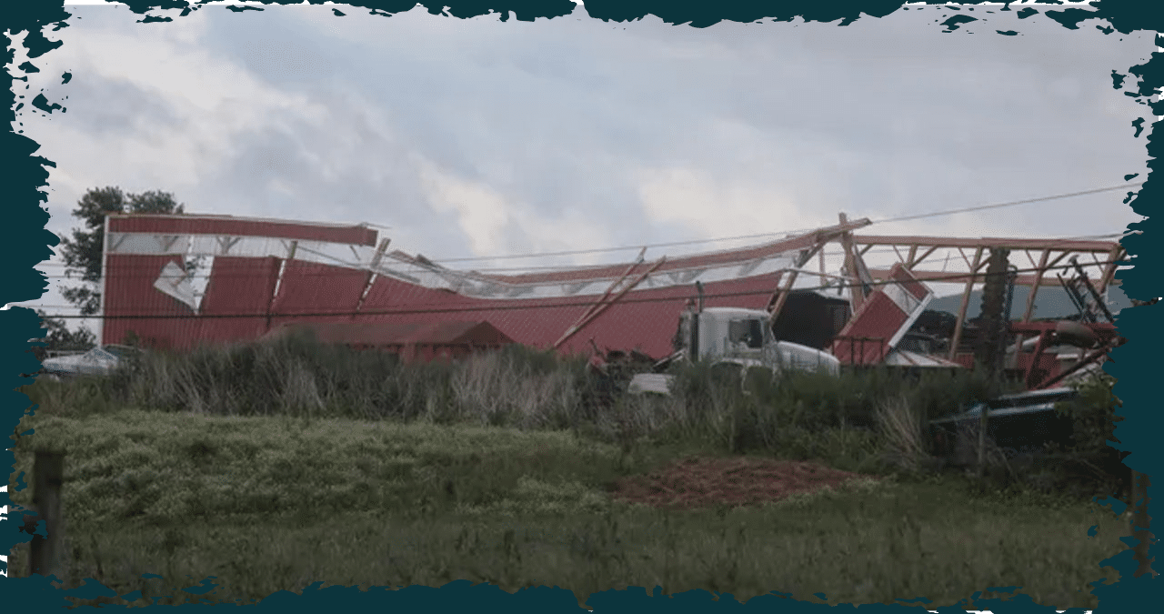
According to the National Weather Service in Buffalo, the Arkwright tornado was the most potent among the three, and it stayed on the ground for an extended period. This tornado was classified as EF-1, meaning it was relatively mild on the Enhanced Fujita Scale, with wind speeds estimated to be around 110 mph, and it traveled a distance of three miles.
The tornado wreaked havoc on countless trees and homes, causing severe damage to roofs and even blowing out walls. The powerful winds were strong enough to uproot or snap off an entire grove of hardwood trees.
A tornado, which was 150 yards wide, began in Arkwright, made its way towards the northeast, and concluded its rampage in just eight minutes in Hanover, Chautauqua County.
According to the Weather Service, the second tornado occurred in Eden and was classified as an EF-0, meaning it was weak, on the Enhanced Fujita Scale. It had winds of approximately 85 mph and travelled nearly 1 mile.
As it made its way through, the tornado caused significant damage to numerous trees in its wake. Many of these trees were uprooted and toppled onto nearby structures, exacerbating the destruction left in the storm’s wake.
As it tore through Eden, the tornado spanned 75 yards and wreaked havoc on the ground for a total of four minutes. Its trajectory was towards the northeast, commencing at the junction of Jennings Road and Kickbush Gulf and culminating at Gary Drive and Sauer Road.
According to the Weather Service, the third tornado in Darien was classified as an EF-0, meaning it was relatively weak, with winds estimated to reach around 75 mph. The tornado traveled for a distance of 1 mile.
According to the Weather Service, the tornado wreaked havoc for a total of four minutes, leaving a path of destruction roughly 50 feet wide. It caused significant damage to the trees in the area before ultimately coming to a halt in nearby Alexander, Genesee County.
On Wednesday, as the remains of tropical cyclone Beryl moved through the area, a number of tornado watches and warnings were issued across the Empire State.
Tornadoes in New York: A history of twisters
New York has encountered more than 500 tornadoes since 1950, with most of them being categorized as relatively weak E-F0 and E-F1 twisters. Nevertheless, the state has witnessed some significant tornado occurrences, such as the May 31, 1985, tornado outbreak that resulted in several powerful tornadoes, including an E-F4 in Chenango County, causing widespread destruction.
Although tornadoes are not as prevalent in New York as they are in areas like the Midwest, they still hold significance in the state’s weather history and can sometimes cause significant damage.
NY tornado database: See the state’s worst twisters in history
Since 1950, the paths and impact of tornadoes in New York have been tracked by the National Oceanic and Atmospheric Administration, providing valuable data.
Explore the tornado data from January 1950 through an interactive map that provides comprehensive information on the extent of damage, injuries, and fatalities caused by recent tornadoes. With this interactive map, you can easily access detailed information and damage estimates of tornadoes.
The map does not show Wednesday’s tornados since the tornado database only covers up to the year 2023. Therefore, any tornados that occurred in 2024 are not included.
This Article Includes