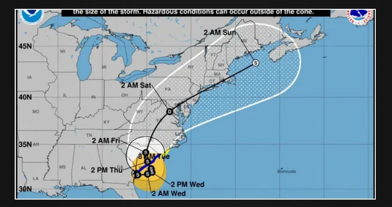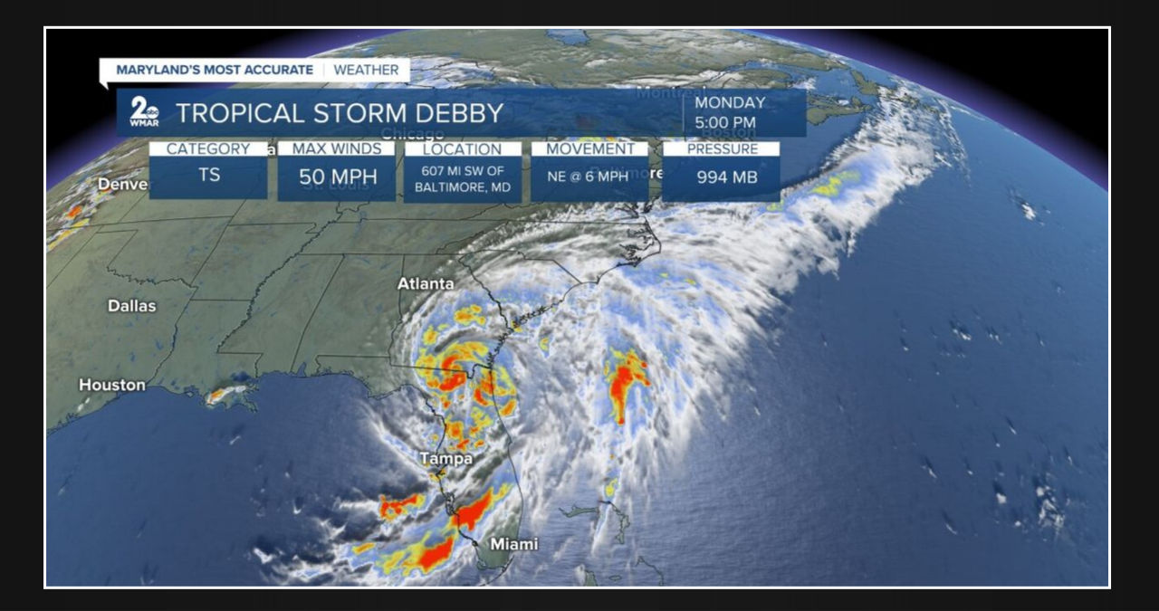
Debby remains the center of attention as it churns over Florida. According to the latest update as of August 5, 2024, at 5:00 PM EDT, it has weakened slightly to a Tropical Storm, with maximum sustained winds of 50 mph.
Earlier this morning, the storm hit land as a Category One with winds reaching 80 mph near Steinhatchee, Florida. As of now, Florida, Georgia, and South Carolina are still experiencing potentially historic rainfall. The southeast remains under Tropical Storm Watches and Warnings.
Maryland is currently within the cone of uncertainty, according to the latest track. This means that over the next few days, the storm will gradually move north, closer to the Mid-Atlantic. While the situation is still uncertain, it is likely that the state will experience heavy rain and gusty winds late in the week. Although not on the scale of what is happening in Florida, it is still a significant event that should not be ignored. Flooding may also be a concern, especially considering the heavy rain the state has already experienced this month. As the storm approaches, temperatures will drop significantly to the low 80s. It’s important to stay weather-aware and prepared over the next few days.