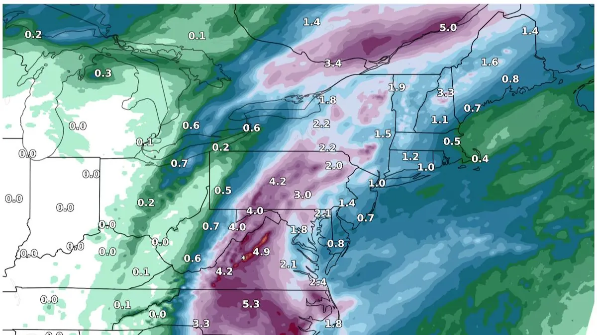
Good morning, everyone. Low pressure continues to meander in wave shape throughout Tennessee, North Carolina, and South Carolina, accompanied by a stationary front. This will provide a replay of today’s afternoon heavy shower and thunderstorm activity, with the possibility of potentially severe weather in some areas.
Sunshine will work through the atmosphere along the front and to the north of it, combining with leftover tropical energy and high humidity. This will help to spark scattered showers and rumbles resembling popcorn across parts of North Carolina, Virginia, and Maryland.
Thunderstorms are currently active east and southeast of Raleigh, North Carolina, with their trajectory pointing towards Wilson. Throughout the day, expect the formation of isolated thunderstorm cells and clusters. While not everyone will experience severe weather, those who do should be prepared for potentially damaging winds, frequent lightning, hail, heavy rainfall, and the slight possibility of a tornado.
In other areas, the southwest region of Pennsylvania, northern West Virginia, and southeast Ohio are experiencing continuous rainfall. Although there are no immediate threats, there is a possibility of a few stronger thunderstorms crossing over from Maryland into Pennsylvania.