Hawaii is currently on alert as a couple of weather systems are making their way towards the islands in the eastern Pacific Ocean, prompting concerns.
Hawaii is currently on alert as there is a noticeable increase in tropical activity over the eastern Pacific Ocean. AccuWeather meteorologists have identified at least two systems that are heading towards the islands.
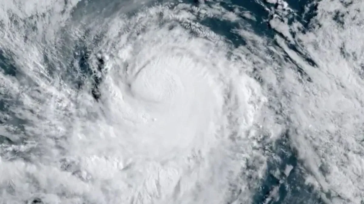
A tropical rainstorm is currently developing approximately 1,000 miles southeast of Hilo, Hawaii.
AccuWeather Lead Hurricane Expert Alex DaSilva mentioned that this system appears to be on the brink of developing into a fully-formed tropical depression or storm.
The rainstorm hovers on the cusp of the “eastern Pacific” and “central Pacific” basins. Should it evolve into a tropical storm in the eastern Pacific, it will be bestowed with the name Hector.
If it strengthens before crossing into the central Pacific, it would be named Hone, one of the tropical names in the Hawaiian language.
AccuWeather had earlier in the week identified the feature as a tropical rainstorm, aiming to closely monitor it and raise public awareness.
According to DaSilva, due to its southern location, there is a possibility that this system will remain south of the island as it approaches over the weekend and into early next week. However, being situated in an area with warmer water, there is a higher chance that it will maintain its intensity as a tropical storm or even strengthen into a hurricane as it approaches.
According to DaSilva, if the system remains fairly strong and holds together, one of the major concerns would be the potential for significant rainfall leading to flooding.
The islands are in dire need of moisture due to the prolonged drought.
According to DaSilva, if the storm loses its organization and some of the rain bands break apart, the lee sides of the mountains might receive minimal or no rainfall. Instead, they may experience strong winds, which could potentially escalate the risk of wildfires.
This weekend, regardless of shower and thunderstorm activity, the islands will experience building breezes and seas, even with a distant passing storm or a weaker storm approaching from the southeast.
2nd system to watch farther east in the Pacific
Meanwhile, there is a hurricane already named over the eastern Pacific, located hundreds of miles to the east of the tropical rainstorm that AccuWeather meteorologists are currently tracking.
Hurricane Gilma, currently a Category 1 hurricane on the Saffir-Simpson Hurricane Wind Scale, is projected to strengthen to a major hurricane of at least Category 3 intensity by the end of the week. It is currently moving towards the west-northwest direction.
According to DaSilva, if this system manages to stay intact, Hawaii might start worrying about it by the end of the month. However, in the coming days, it will face a battle for survival. Even though it is heading more directly towards the islands, it will also encounter cooler waters that are not conducive for tropical systems to flourish.
In late month, the islands could potentially experience showers, thunderstorms, gusty winds, and rough seas as Gilma, although weakened, still poses a threat.
How common are tropical storms and hurricane strikes in Hawaii?
Tropical storms and hurricanes rarely make direct hits on Hawaii, including those that approach from the east. This is mainly due to the cool waters at Hawaii’s latitude, which discourage storms from moving closer. Additionally, storms that travel further south tend to pass by to the west of Hawaii.
The Big Island, with its towering mountains reaching almost 14,000 feet above sea level, serves as a formidable barrier against powerful storms approaching from the east. This natural shield effectively protects the rest of the String of Pearls from potential impacts.
In September 2018, Hawaii experienced the landfall of its final tropical storm, Olivia. Although it had weakened to a tropical storm by the time it reached Hawaii, Olivia had previously intensified to a Category 4 hurricane on the Saffir-Simpson wind scale. The island of Maui bore the brunt of Olivia’s impact, suffering from severe flooding, heavy rainfall, and strong winds. Interestingly, Olivia made history as the first tropical cyclone to ever make landfall on Maui and Lanai.
In 2018, Hawaii narrowly avoided a destructive Category 5 hurricane named Lane. Thankfully, Lane significantly weakened and did not hit the islands.
The cliffs near the Halona Blowhole in Waimanalo, Hawaii, were pounded by massive waves on Friday, August 24, 2018, as Hurricane Lane approached Oahu. The powerful ocean swells made a significant impact on the coastline, creating a dramatic scene. The force of nature was captured in a striking photograph by Marco Garcia, an Associated Press photographer.
In September 1992, Hurricane Iniki was the most expensive hurricane to hit Hawaii before Dora’s destructive impact last August. This powerful Category 4 hurricane caused approximately $3.1 billion in damages (1992 USD) when it made landfall on the island of Kauai.
This Article Includes

