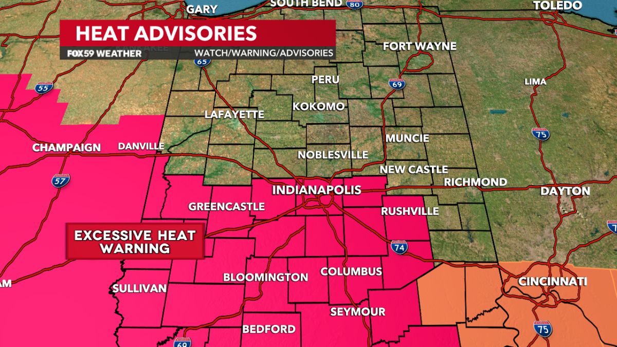
In the past few days, Louisiana, Texas, and Mississippi have been experiencing scattered flooding due to rounds of heavy rain caused by a stalled frontal system. On a concerning note, record high temperatures were also observed on Sunday in Galveston and Dallas.
A new weather system is on the horizon as the previous front moves east. This system is expected to originate from the Midwest and lead to numerous thunderstorms over the next few days. According to the top of the page, this could result in widespread flash flooding across parts of Texas from Monday through Wednesday. While isolated flooding is possible, scattered flash flooding is expected to occur during this time frame.
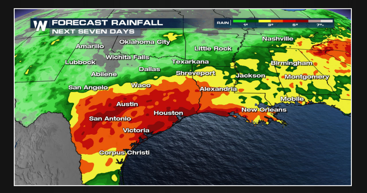
Thunderstorms are anticipated to be at their peak during the afternoon and evening hours until Thursday. Although a few severe storms may be possible, the greater concern is flooding. Over the next week, a significant amount of rainfall- ranging from 3-6 inches- is expected to impact a large part of Texas and Louisiana, with the majority of it falling south of I-20. Multiple thunderstorms may cause isolated areas to receive over 8 inches of rainfall. A screenshot of the weather forecast is shown below.
The South is facing a potential threat of flash flooding through Thursday as warned by the Weather Prediction Center (WPC). According to the WPC, the highest risk of flooding is anticipated between Monday and Wednesday.