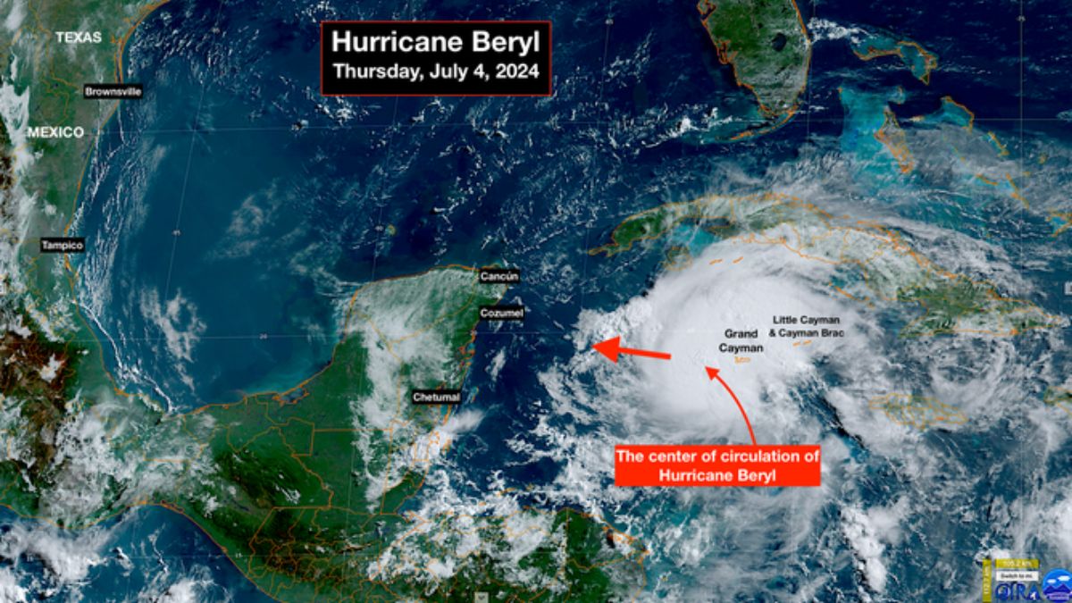
The core of Hurricane Beryl has passed over the Cayman Islands, and the weather will gradually improve there today. Throughout the rest of today and tonight, the hurricane will travel across the open western Caribbean.
The official National Hurricane Center forecast predicts that the storm will diminish during this time because computer models show Beryl moving into a challenging environment with strong headwinds and dry air.
There are some questions, though.
First, the western Caribbean sea is quite warm, giving the storm enough energy to create thunderstorms to combat the dry air. Second, in the western Caribbean, the east-to-west winds that blow across the water usually relax, allowing hurricanes to strengthen. Third, Beryl battled off dry air and high winds yesterday, and its core is still intact despite receiving a beating.
An unbroken core means that the system can simply re-intensify if the unfavorable conditions improve.
Computer forecast models are our finest tools for anticipating what a storm will do, but other considerations indicate that there is significant uncertainty regarding Beryl’s strength when it reaches the Yucatán.
Everyone on the Caribbean side of the Yucatán Peninsula, including the major resort cities of Cancun, Cozumel, and Tulum, should be alert to local emergency information. The weather will worsen later today, with Beryl’s most severe effects occurring overnight.
As it moves across the Yucatán peninsula, we expect the hurricane to weaken. Later tomorrow, the core will emerge in the Gulf of Mexico. When Beryl crosses land, the National Hurricane Center anticipates the storm will fall to less than hurricane status. If the storm moves northward, like it did yesterday, it will cover less land before reaching the Gulf.
The expected upper-level winds over the Gulf appear to be favorable for Beryl to strengthen; however, there will still be dry air. By then, its forward speed will have slowed dramatically, so Beryl may have enough time to restore hurricane classification. We need to get ready for the storm to surpass the predicted Category 1 strength.
According to one forecasting guideline, slower-moving storms have larger forecast errors. Prepare for this regulation to apply to Beryl in the Gulf.
The consensus among computer forecast models is that Beryl’s center will make landfall near the Mexico/Texas border, plus or minus. If this is right, there will be substantial repercussions in South Texas, including strong winds, heavy rain, and storm surge along the coastline. The circulation surrounding Hurricane Alberto earlier this year affected this same coastline.
A jet stream dip over the Midwest will cause the storm to arc north slightly in the Gulf. If Beryl continues to be powerful, it is likely to track northward and have a greater impact on Texas. Should upper-level winds and dry air, along with a trip across the Yucatán Peninsula, significantly weaken the system, the center of Beryl is more likely to track into Mexico, despite its effects remaining in Texas.
For the time being, everyone on the Texas coast should make plans to stay informed in the coming days. Undoubtedly, South Texas will experience some effects. The only question is the degree. Impacts may occur further north, but the likelihood is low at this time.
What’s after Beryl?
Invest 96L, the next disturbance on our radar, has been identified by the National Hurricane Center as a surge of moisture accompanied by strong gusts of wind. As it moved through the eastern Caribbean islands yesterday, winds reached over 50 miles an hour.
Today in Puerto Rico, the system is creating turbulent tropical downpours. According to the National Hurricane Center, there is a low probability of the system forming a circulation. It is expected to persist as a surge of gusty moisture moving through the Caribbean.
Over the next week or more, a thick cloud of Saharan dust will expand across the Atlantic, which means that there won’t be any significant advancements for some time.